

Transcription
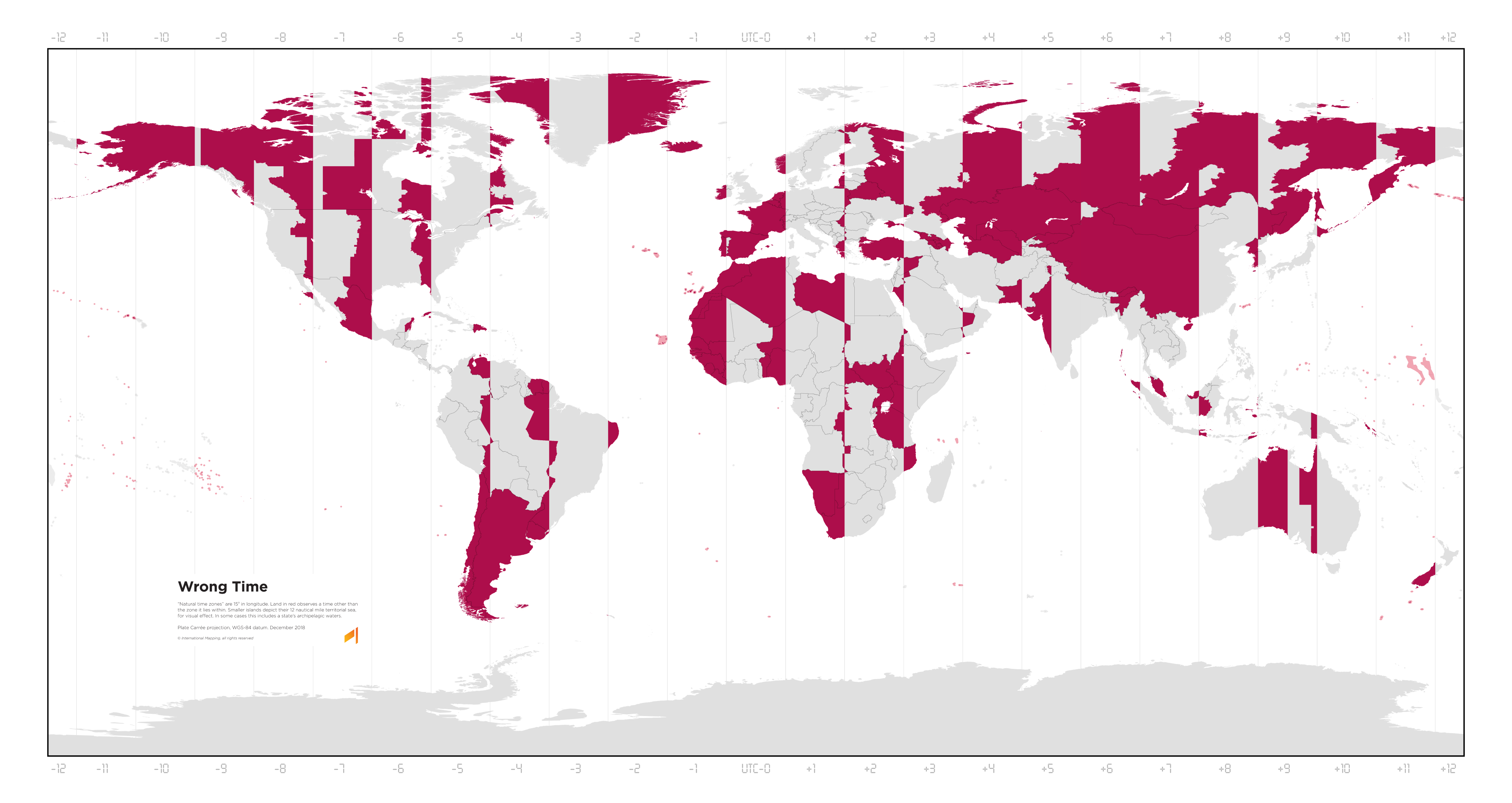
A map of the world with vertical lines marking the time zones from UTC-12 to UTC+12. It has a legend:
Wrong Time
“Natural time zones” are 15° in longitude. Land in red observes a time other than the zone it lies within. Smaller islands depict their 12 nautical mile territorial sea, for visual effect. In some cases this includes a state’s archipelagic waters.
Plate Carrée projection, WGS-84 datum. December 2018 © International Mapping, all rights reserved.
This map really brings home how awful this projection is for this map’s purpose and how awful most projections really are near the poles. Greenland isn’t that big. I know this map is Plate Carree, not Mercator, but the size issue of an equirectangular projection is really similar when comparing longitude and size for the entire globe from pole to equator. 15 degrees of longitude for a timezone stops making sense that close to the poles. Greenland would mostly fit in the central time zone of the United States for example. Given its sparse population, dividing it up into 3 timezones seems unnecessary.